Buildings built with tin money and dredger steel · Architecture that remembers the town
Read Takua Pa through the shophouses on Culture Street, Boon Sung Iron Bridge, the governor's residence, and Tao Ming School · The transition embedded in brick, mortar, and steel structures
If you walk through the Thanon Udom Thara and Thanon Si Takua Pa areas today, the first sight is rows of Sino-Portuguese shophouses. The front walkway has a roof cover known as 'Ngo Ka Ki' which provides shade and rain protection for pedestrians. It feels like stepping back in time to a well-preserved past.
But these buildings are not just beautiful backdrops for photography. They are a massive archive recording the changes of Takua Pa in the form of brick, mortar, and steel structures. Each piece of architecture tells the story of a town that grew and prospered through tin mining, water trade, and the blending of people from diverse cultures.
To deeply understand Takua Pa's architecture, we must look beyond its external beauty. We need to distinguish between what is 'newly built' and what is 'repaired', and understand the layers of history hidden within the governor's residence walls, the miners' iron bridge, and the school built from merchants' donations.
The governor's residence and the wall that tells of conflict
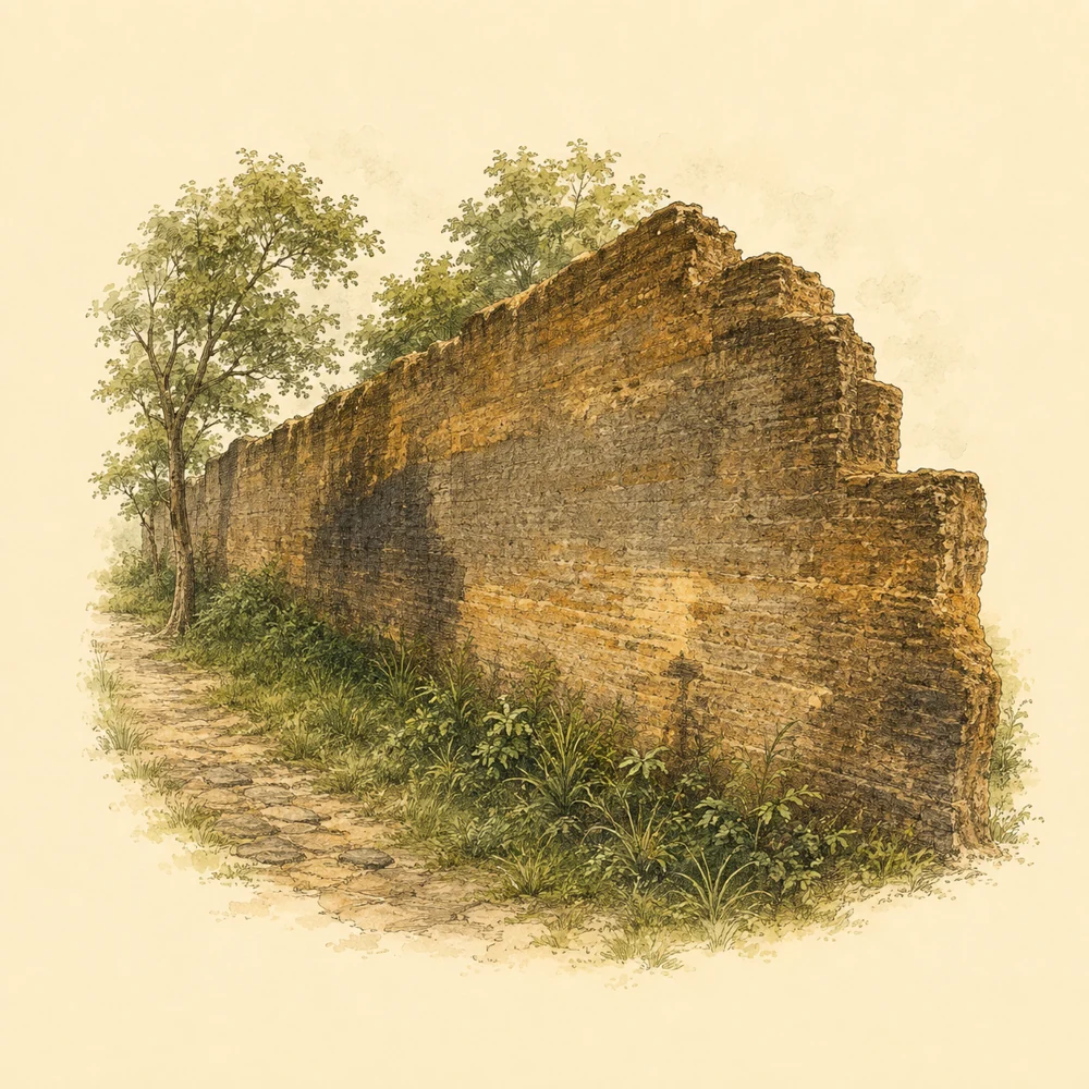
Back in the era when Takua Pa was growing from the tin mining economy and coastal trade, wealth came with conflicts of interest. The wall of the Takua Pa governor's residence was built to act like a camp wall, protecting against danger and serving as a refuge for townspeople. Scholars suggest, though not settled, that this wall was built during the time when Phraya Senanuchit (Nuch Na Nakhon) was the governor between 1840 (2383 BE) and 1881.
The wall was constructed with plaster mixed with gravel and sand, layered with a base wider than the wall itself for stability. The part that remains today is about 5 meters high. The inner area was once divided into a front palace, a main hall, and a rear palace, reflecting the systematic space allocation of the town's rulers in that era.
Important evidence confirming the prosperity of trade in that era comes from the archaeological excavation by the Fine Arts Department in 1999, which found Qing dynasty Chinese ceramics, European ceramics, glassware, and building decorative parts. These items confirm that this governor's residence was once connected to a global trade network.
When the city center moved to Ko Kho Khao and Ban Yan Yao, the former governor's residence lost its administrative role. However, today this area has become an open archaeological site that the community uses for cultural events, such as the 'From Takola to Takua Pa' festival, bringing the old walls back to life as the city's stage.
Architecture is not just a beautiful backdrop. It is an archive recording the changes of Takua Pa in the form of brick, mortar, and steel structures.
The district chief's house in the transition era
The transition from the governor system to the district system was recorded in the architecture of 'Ban Khun In'. According to local evidence, this house was built around 1917 (B.E. 2460) by Chinese craftsmen to be the residence of Lieutenant Khun Intharakhiri (Choi na Nakhon), a descendant of the governor lineage who later became the Takua Pa district chief.
The building is a two-story brick and masonry structure in an applied Sino-Portuguese style, reflecting the architectural influence from port cities like Penang and Singapore that spread through maritime trade. This house therefore not only displays the status of its owner but also serves as evidence showing Takua Pa's connection to the outside world.
In reading history from architecture, we must be careful to distinguish between the year of construction and the year of repair. A report from the Office of Natural Resources and Environmental Policy and Planning indicates that the Na Nakhon family repaired this house in 1981, trying to preserve the original style but changing the roofing material to corrugated tiles.
Knowing this repair information helps us see Ban Khun In not just as a static past, but as a living structure that has been maintained and improved by its residents over many decades.
From an industrial structure, the Boon Sung Iron Bridge has changed its role to a community thoroughfare and has become a major landmark attracting people to visit the traces of the mining town.
Educational funds from mining and merchant networks
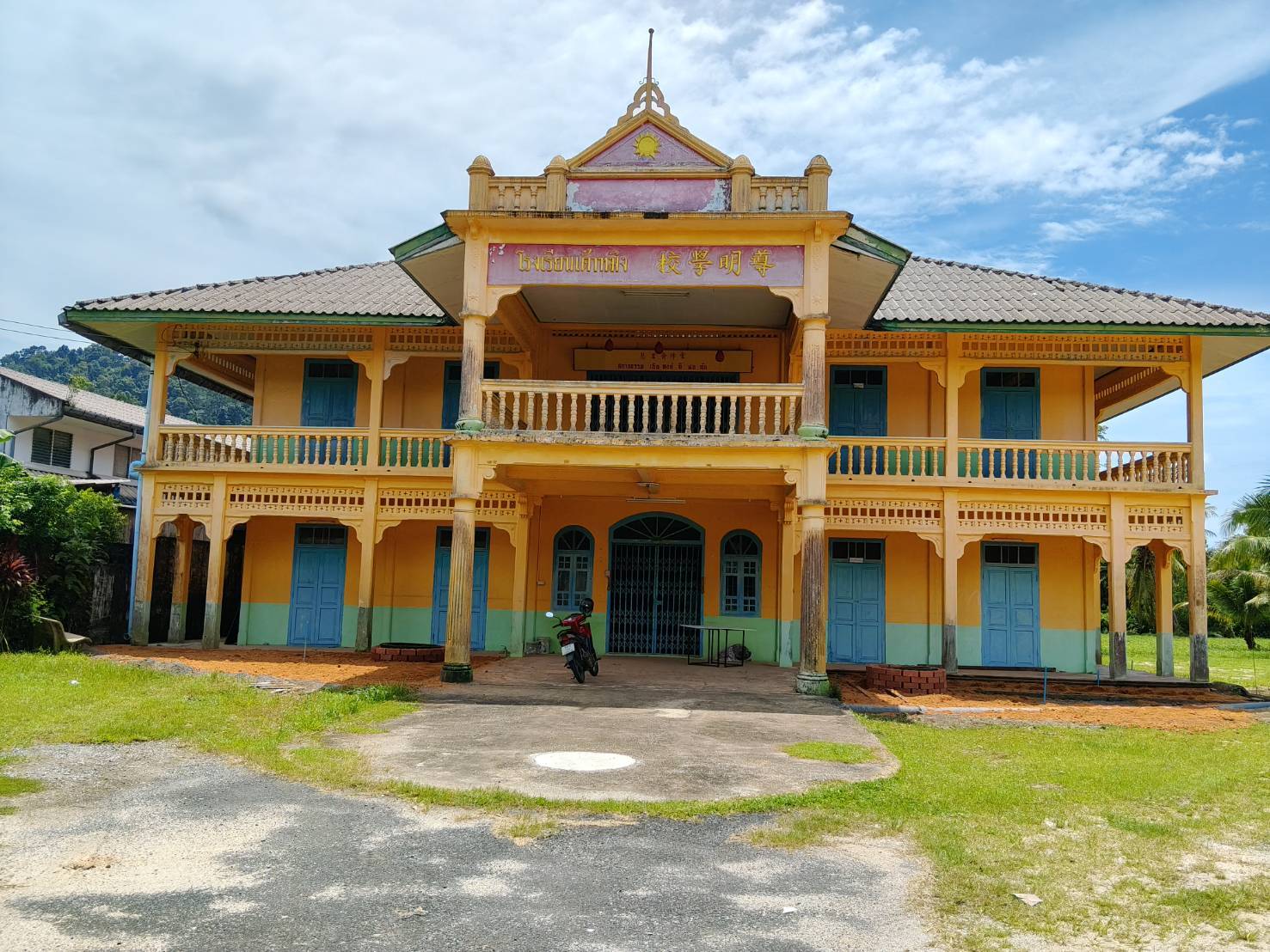
The wealth from tin mining was not only spent on building private residences, but also led to the creation of community institutions. The 'Tao Ming School' building, constructed in 1922 (B.E. 2465), is a clear example of community collaboration.
Funds for constructing this school came from fundraising among wealthy miners and Chinese merchants from the Old Town market, Yan Yao, Ranong, and Phuket. This shows the strong geographical and economic network of the Chinese community in this region.
The school building was built by Chinese craftsmen in an applied Sino-Portuguese style and operated as a primary school for a long time. It served as a center for passing on knowledge, language, and culture to generations of Thai-Chinese children in Takua Pa.
Even though the school has ceased its teaching operations today, the building is still maintained by the Takua Pa Tao Ming School Foundation, standing as a memorial to the community's commitment to education during the town's golden era.
From a tin dredger to a workers' bridge

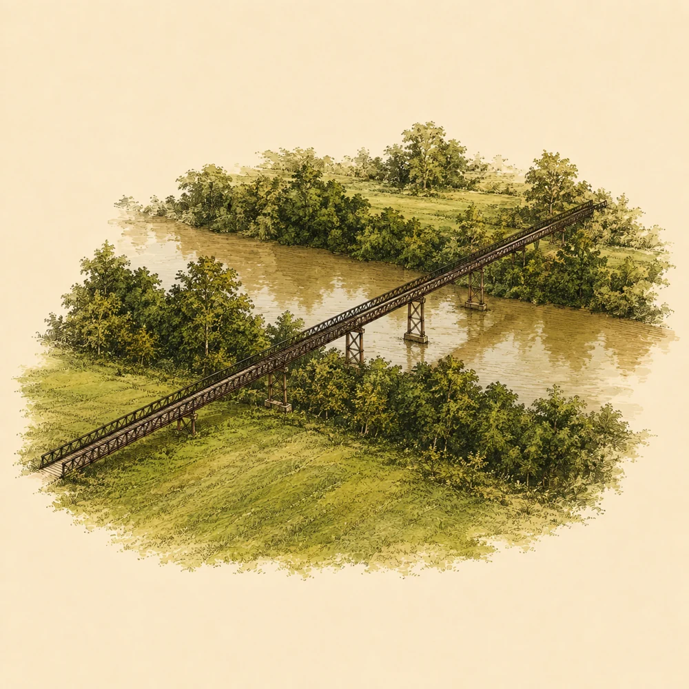
While residences and schools reflect the wealth of merchants, the 'Saphan Lek Bun Sung' (Bun Sung Iron Bridge) tells the story of the industrial era and the working class. This bridge was built in 1968 (B.E. 2511) and is a direct product of the city's tin mining industry.
Before the bridge existed, miners and villagers had to rely on rowboats to cross the Takua Pa Canal, which is over 40 meters wide, making it extremely difficult during the flood season. Although a wooden bridge for pedestrians and bicycles had been built, as the industry expanded, the demand for a stronger structure increased.
The Juti Boon Sung Dredging Company initiated the construction of this bridge by assembling the steel frames from a decommissioned dredger to form the Khok Khanun iron bridge, which is over 200 meters long. This bridge became an important shortcut connecting the Old Town market area to the mining area, facilitating labor and transportation.
Although the sound of mining machinery has long gone silent today, the iron bridge remains. It has changed its role from an industrial structure to a community thoroughfare and has become a major landmark that attracts people to visit the traces of the Takua Pa mining town.
Culture Street and shophouses brought back to life
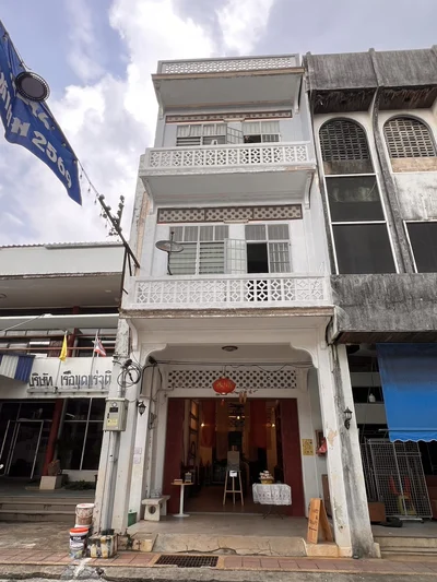
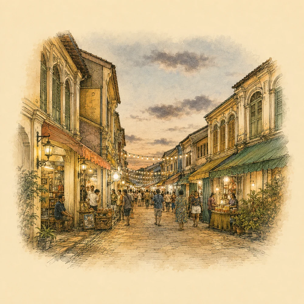
The shophouses along both sides of Udom Tara and Sri Takua Pa streets are the town's most prominent architectural heritage. These buildings were built to align with the commercial lifestyle, featuring ground-floor spaces for business and connected Ngo Ka Ki walkways. These buildings were influenced by Straits colonial architecture, reflecting the trade networks with Penang and Singapore.
After the tin mining industry declined and the town's commercial center moved away, this Old Town market area faced quietness. Many buildings were left to decay over time, as if the golden era of this street had passed.
However, the surviving architecture has become an important asset in revitalizing this area. Around 2007 (B.E. 2550), the 'Takua Pa Old Town Reminiscing' project was initiated, piloting the opening of the street space as a cultural walking street before developing into the current Takua Pa Old Town Cultural Street.
Every Sunday, this street is closed to traffic and opens as a bustling market. The old Sino-Portuguese buildings return to their role as a backdrop for community activities, including the selling of local food, crafts, and performances, proving that past architecture can find new life and roles in the present day.
Where to visit in person
Takua Pa Old Town Cultural Street
Governor’s Residence Wall
Boon Soong Iron Bridge
Khun In House
Tao Ming School
Missing data
- The exact years of construction for Ban Khun In and the Takua Pa governor's residence wall
- Documentary information on the later structural repair and restoration of the Boon Sung Iron Bridge
Sources
- Old town boundary demarcation project · Takua Pa Old Town · Office of Natural Resources and Environmental Policy and Planning (ONEP) · PDF pages 55 to 58 · View sources (Accessed 2026-09-07)
- Tao Ming School building · สผ. (ONEP) Cultural Art Environment Database · Significance/Characteristics section · View sources (Accessed 2026-09-07)
- Khun In building · สผ. (ONEP) Cultural Art Environment Database · Significance/Characteristics section · View sources (Accessed 2026-09-07)
- Governor’s Residence Wall · Princess Maha Chakri Sirindhorn Anthropology Centre (public organisation) · Archaeological highlights · View sources (Accessed 2026-09-07)
- Thanon Watthanatham Mueang Kao Takua Pa · Department of Internal Trade · Market records · View sources (Accessed 2026-09-07)